Aunu'u (Aunu‘u)
Aunuu is a small volcanic island off the southeastern shore of Tutuila in Saole County, American Samoa. It has a land area of 374.83 acre, and a 2010 census population of 436 persons. Politically, it is a part of the Eastern District, one of the two primary political divisions of American Samoa.
Aunuu Crater contains the freshwater Fa'amulivai Marsh, the largest such wetland in American Samoa. It was formed from the drainage of the low-lying crater. It is part of a protected National Natural Landmark on Aunuu that was designated in 1972. The Pacific black duck was seen in the marsh in 1976, but it may now be extinct in the region; another significant local bird is the purple swamphen. This marsh is the only place in American Samoa where the Chinese water chestnut grows.
Since the 1960s, the Aunuu people’s main economic activity has been growing taro and producing faausi.
Aunuu has two historical sub-divisions: Salevatia, and Alofasau.
Map - Aunu'u (Aunu‘u)
Map
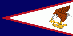
Country - American_Samoa
 |
 |
American Samoa consists of five main islands and two coral atolls; the largest and most populous island is Tutuila, with the Manuʻa Islands, Rose Atoll and Swains Island also included in the territory. All islands except for Swains Island are part of the Samoan Islands, The total land area is 199 sqkm, slightly more than Washington, D.C. As of 2022, the population of American Samoa is approximately 45,443 people, of whom the vast majority are indigenous ethnic Samoans. Most American Samoans are bilingual and can speak English and Samoan fluently.
Currency / Language
| ISO | Currency | Symbol | Significant figures |
|---|---|---|---|
| USD | United States dollar | $ | 2 |
| ISO | Language |
|---|---|
| EN | English language |
| SM | Samoan language |
| TO | Tongan language |


